MNG
Kings Park Feature Survey using mobile and airborne laser scanning
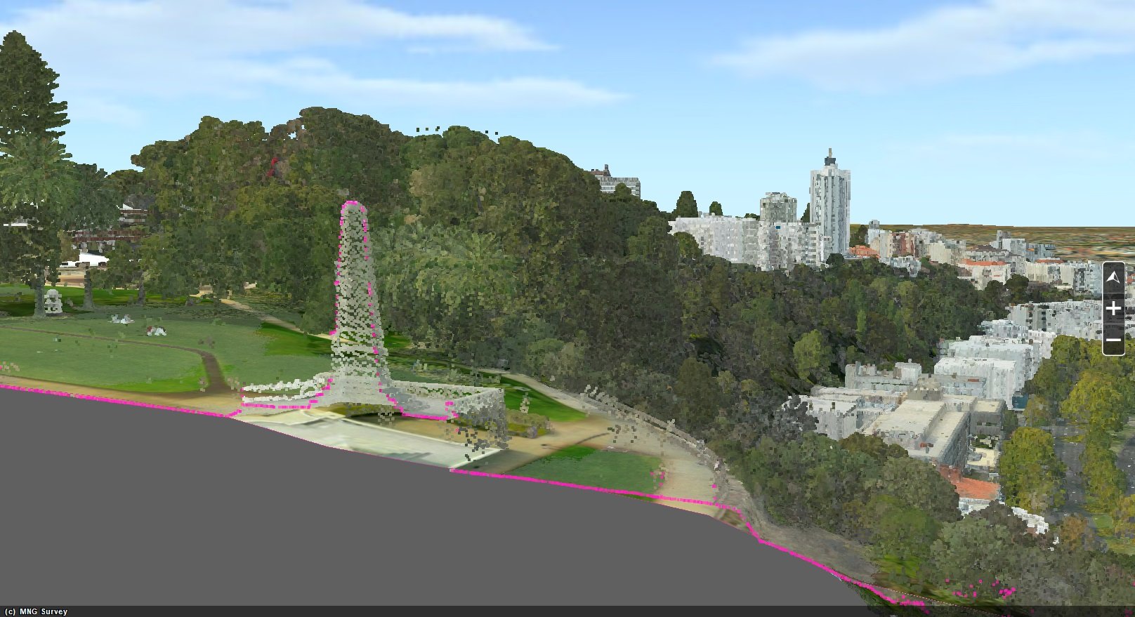
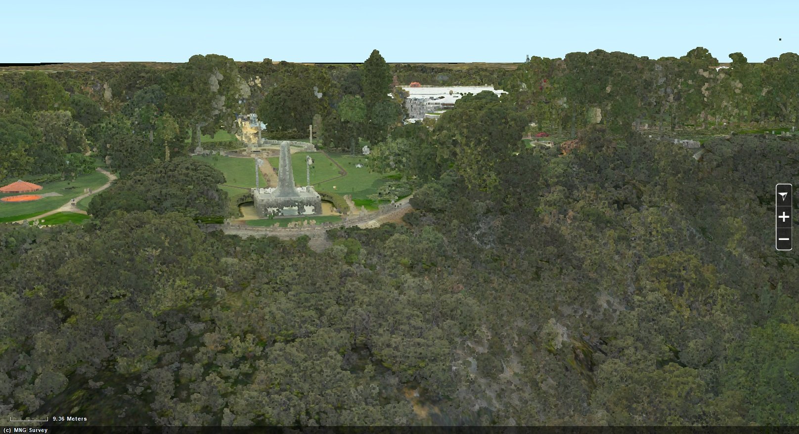
Kings Park, perched above Perth City, is one of the largest inner-city parks in the world. At just over 4km2 the botanical gardens house over 2,000 of Western Australia’s local plant species including unique wildflowers. The Kings Park Botanic Gardens and Parks Authority are internationally recognised for their scientific research, leading horticulture, conservation and public education.
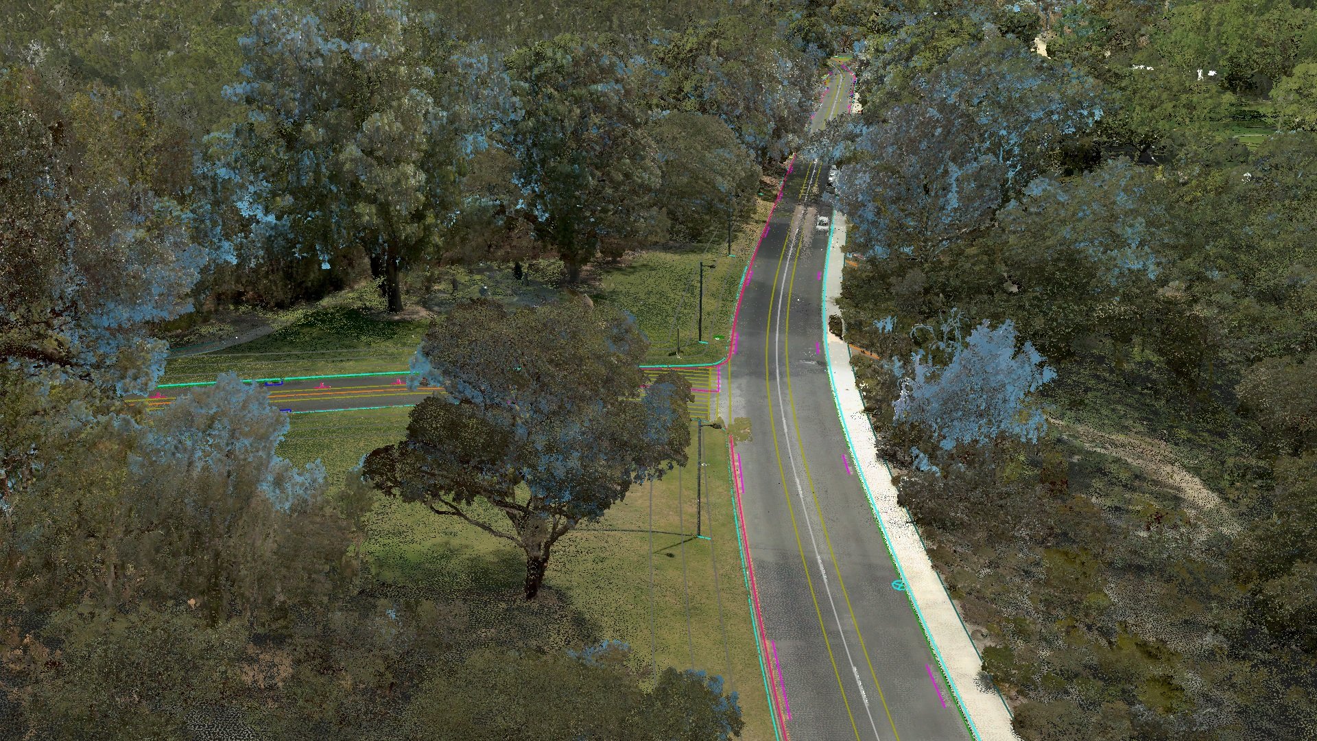
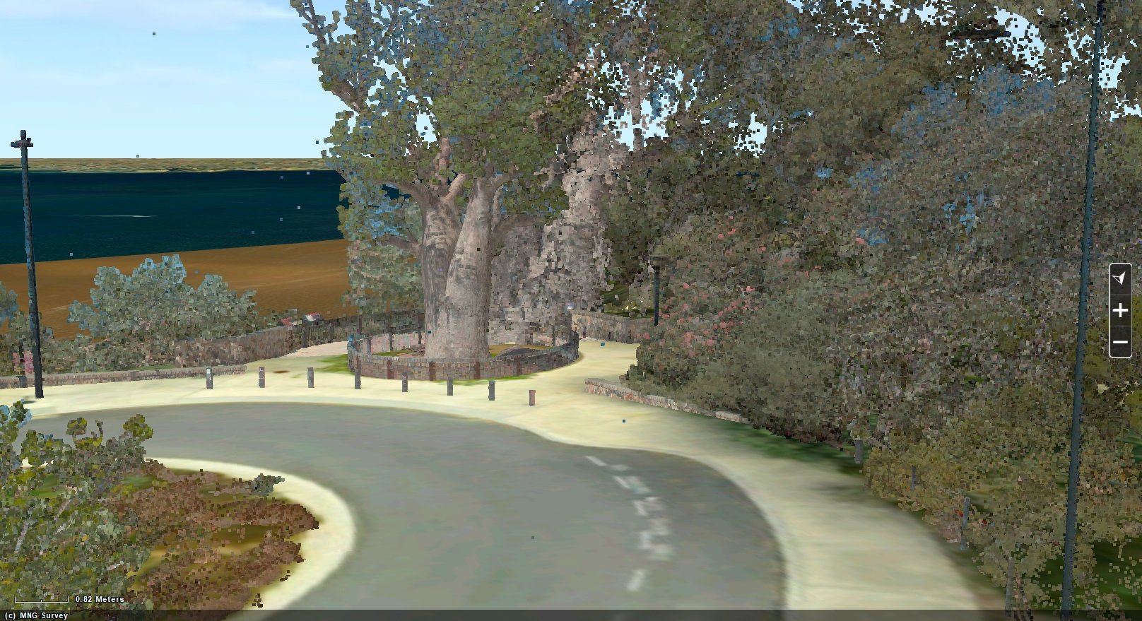
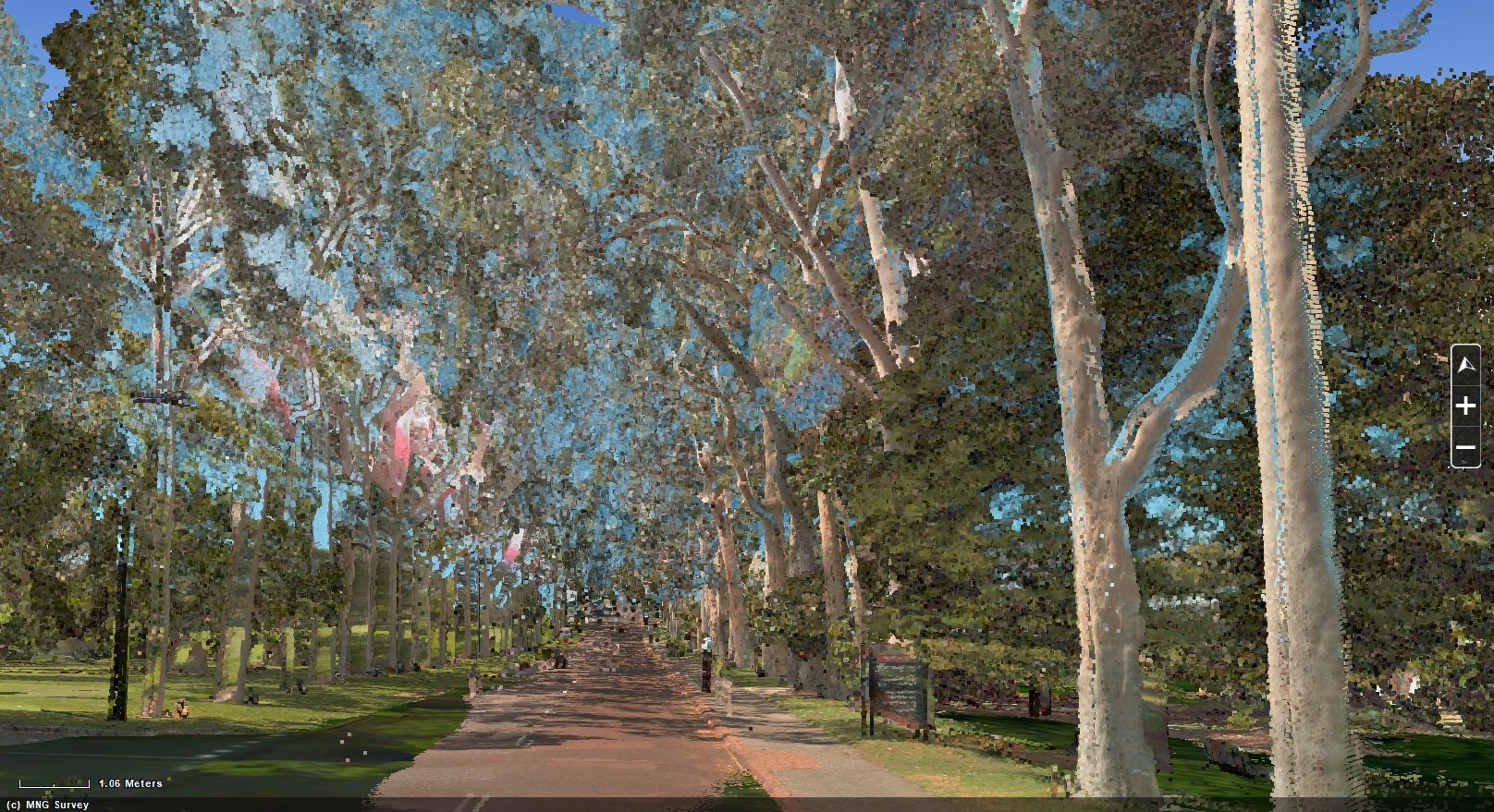
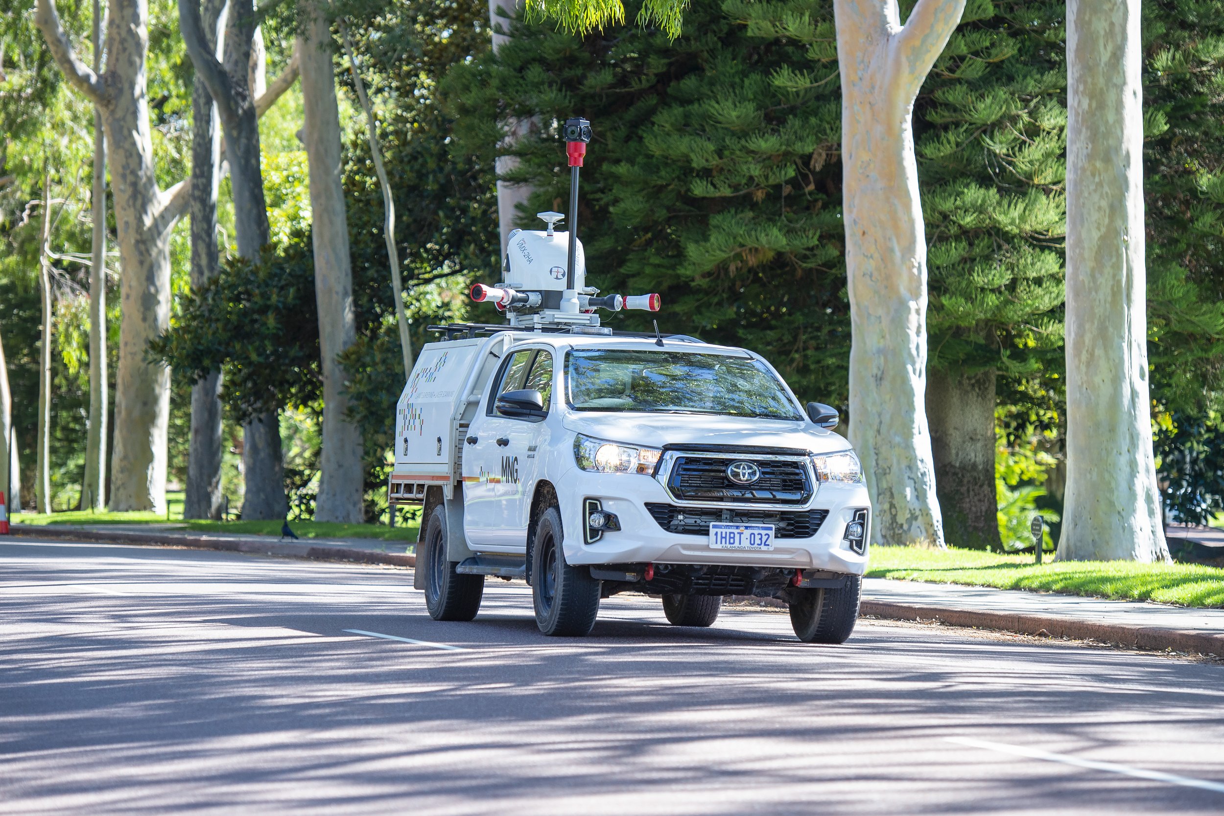
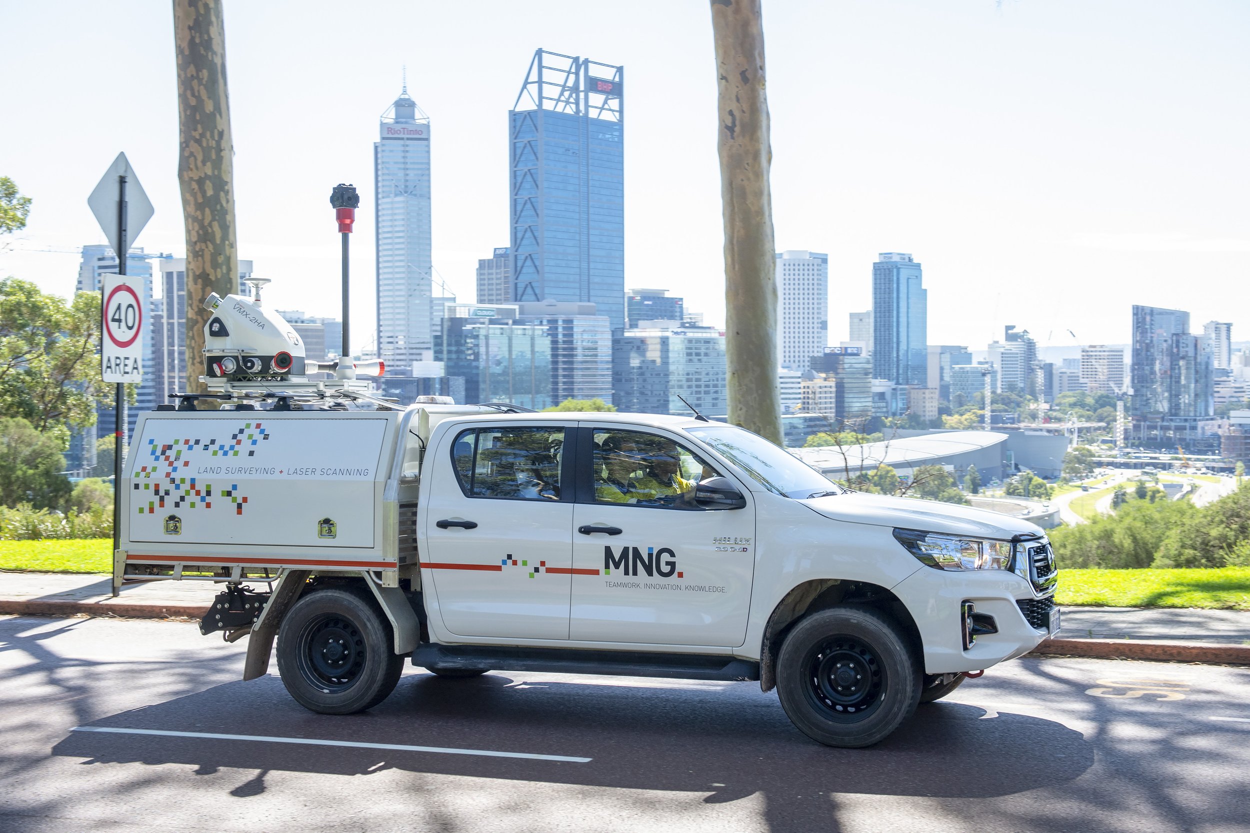
Access through the park is provided by several roads and as part of the planned upgrades and resurfacing of the 10km network a detailed survey of the roads was required for detailed design planning purposes. It was quickly recognised that Mobile Laser Scanning would be the most efficient methodology to deliver the exacting tolerances required to Main Roads Western Australia standards.
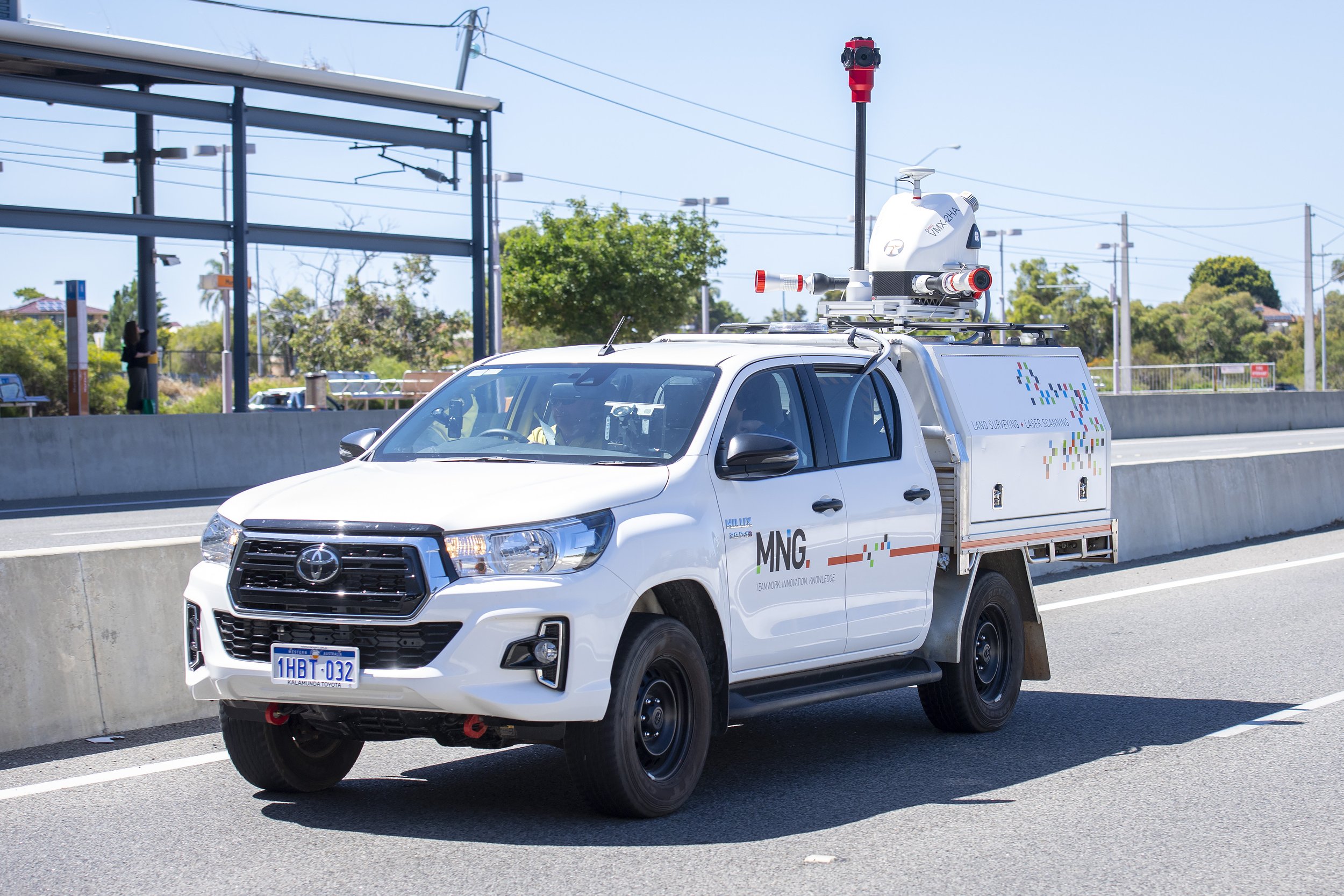
MNG proposed to use their new Riegl VMX-2HA MLS system on the project coupled with the Flir Ladybug 5+ 360° spherical camera for imagery to conduct the survey. Multiple passes along the roadways with concurrent GNSS base station recordings, were validated with checks at intervals not exceeding 400m.
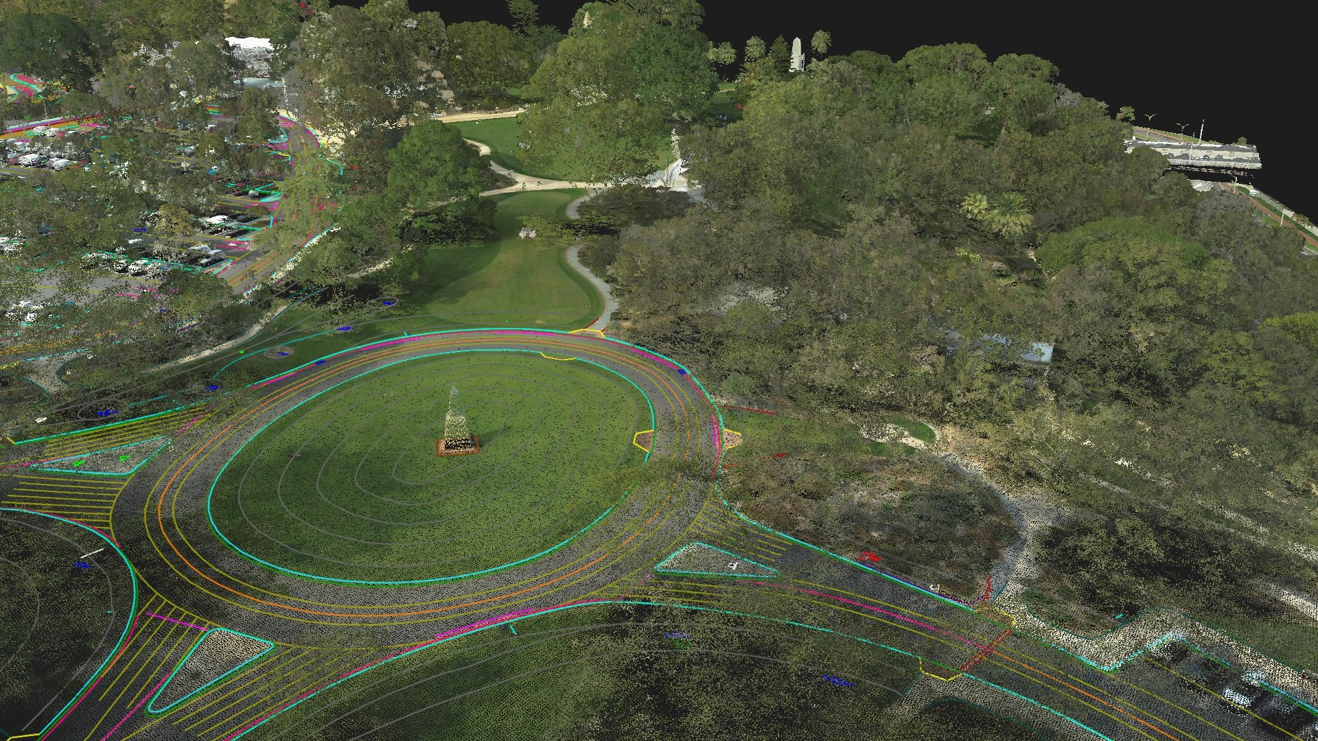
In discussions with the client MNG also advised that their Riegl VQ-480 II Aerial Laser Scanning system was available in Perth and could be used to complement the detailed survey across the park. Flight lines were planned with parallel and orthogonal flight paths achieving over 80pts /m2. Riegl's Waveform-LiDAR technology enables high speed, high accuracy measurements making it ideal for multi-target situations through vegetation
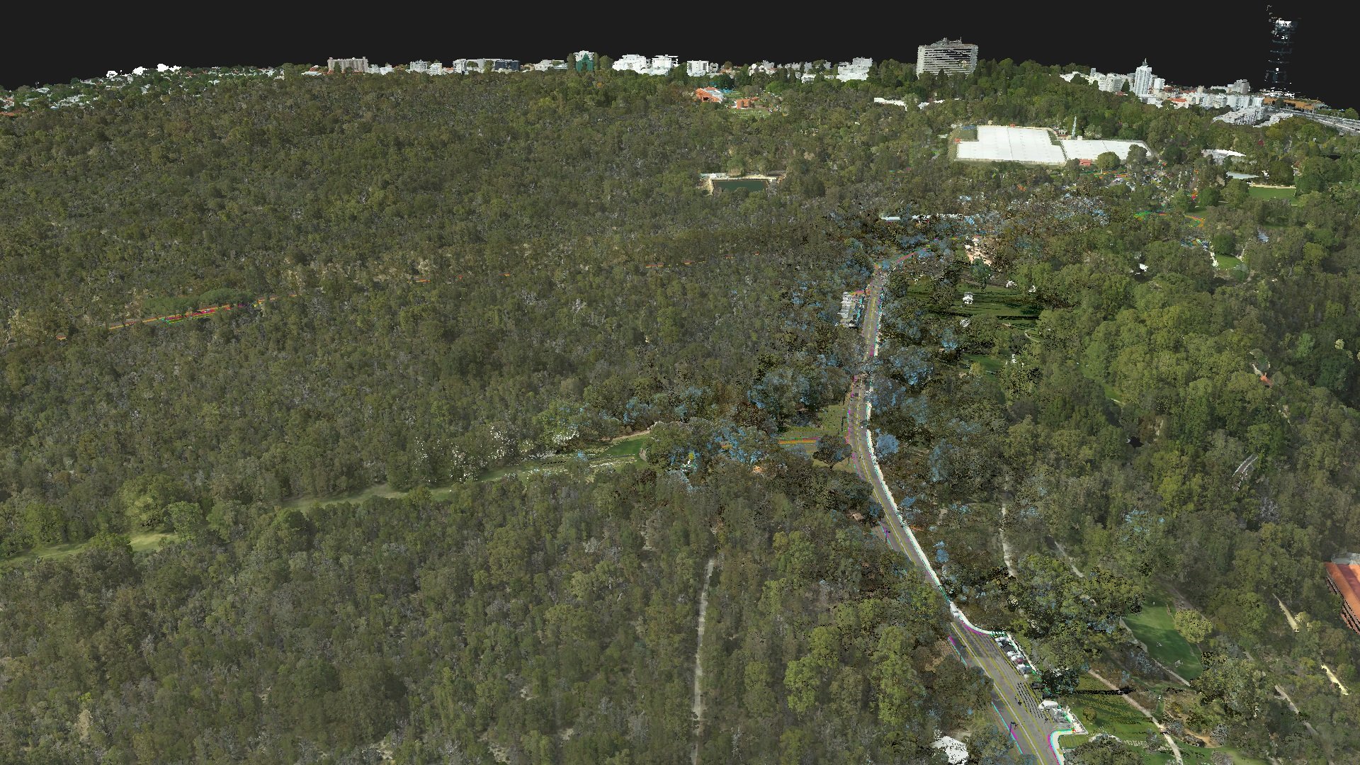
As over 60% of Kings Park is natural bushland and difficult terrain to move through the ALS system is ideal to survey the terrain. MNG’s ALS system is equipped with the Hasselblad aerial camera for concurrent high resolution RGB imagery to achieve 9cm GSD imagery. In addition to the RGB aerial imagery a further flight with a near infra-red sensor enabled a normalised difference vegetation index (NDVI) model to be generated.
A challenge to capturing MLS along the winding roads through the park is the tall roadside vegetation that the park is famous for. Overhead tree canopies denied clear satellite coverage to the MLS system along the majority of the roads. The renowned 30m tall Lemon Scented Eucalypts that line Fraser Ave have inter-locking canopies which provide shade along the roadway, but also restrict GNSS signals.
However, a significant benefit of having the ALS dataset, which had clear GNSS signals, enabled it to be used to assist in the independent control of the MLS point cloud to achieve the specified tolerances. The aerial and mobile LiDAR datasets could then be merged to provide a superior product for the road upgrade, plus map the urban forest terrain throughout the park.