RM Surveys
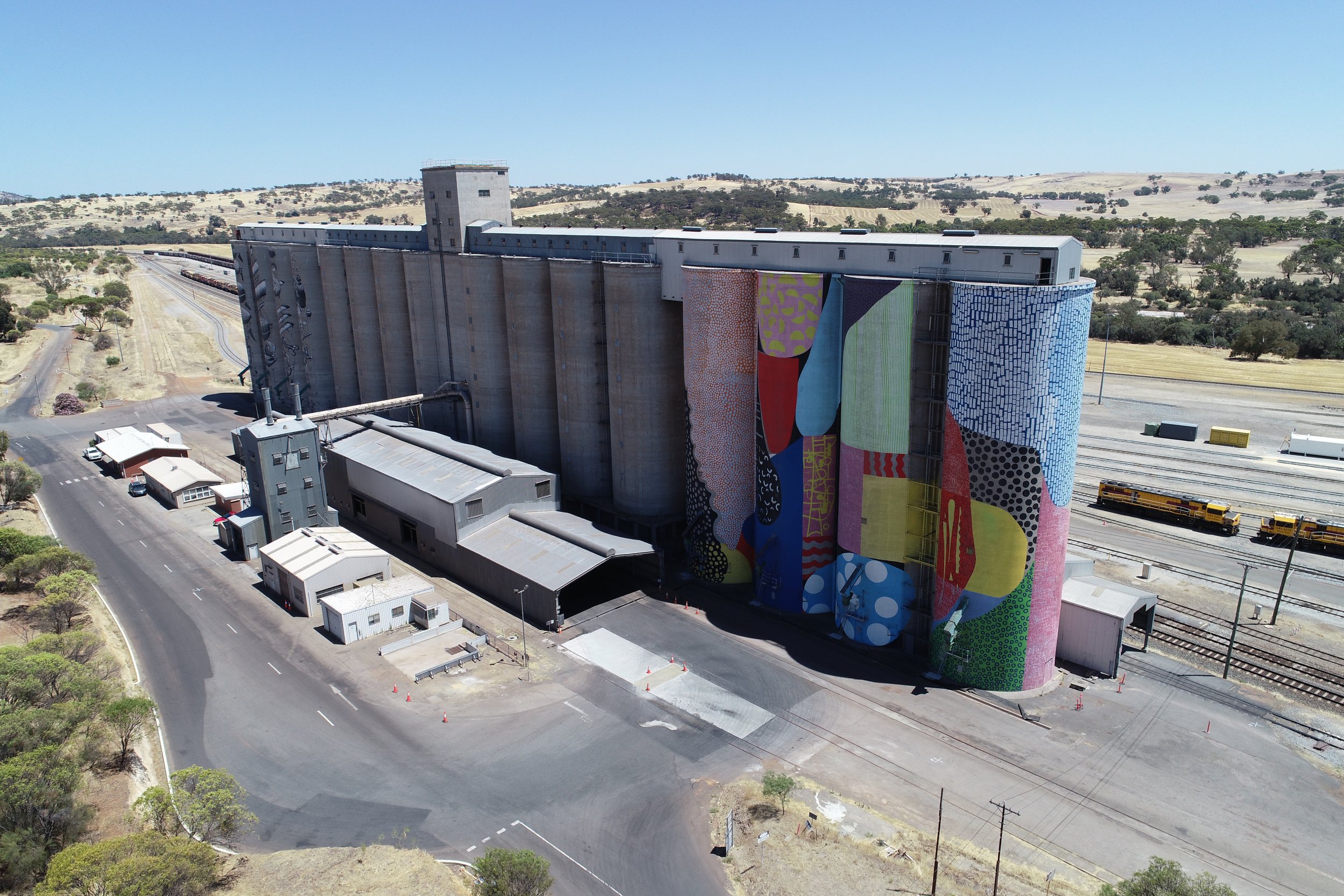
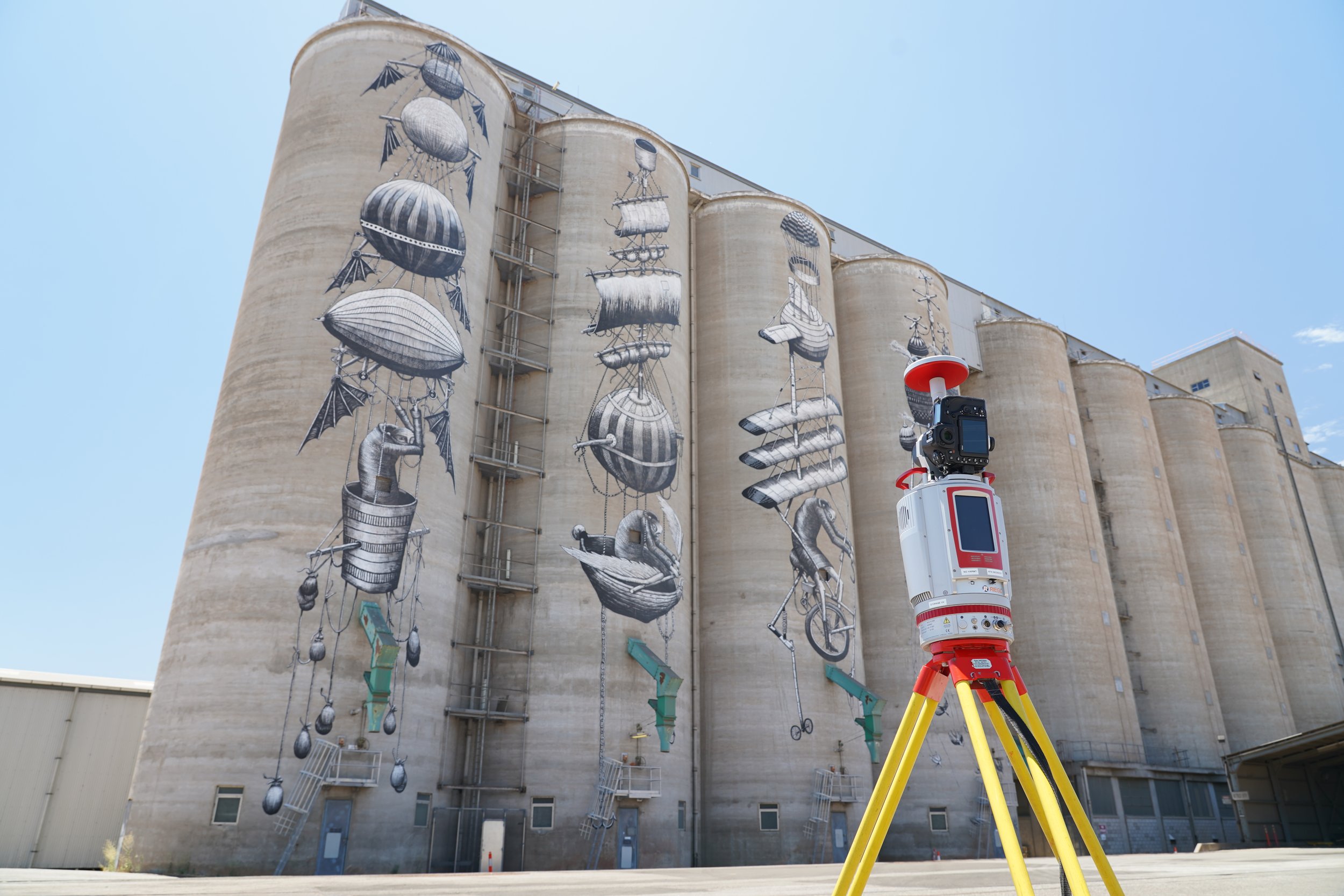
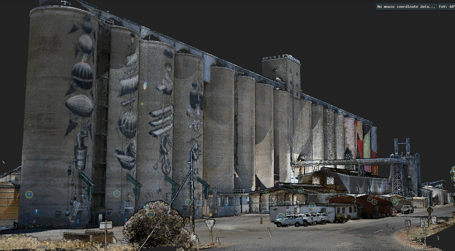
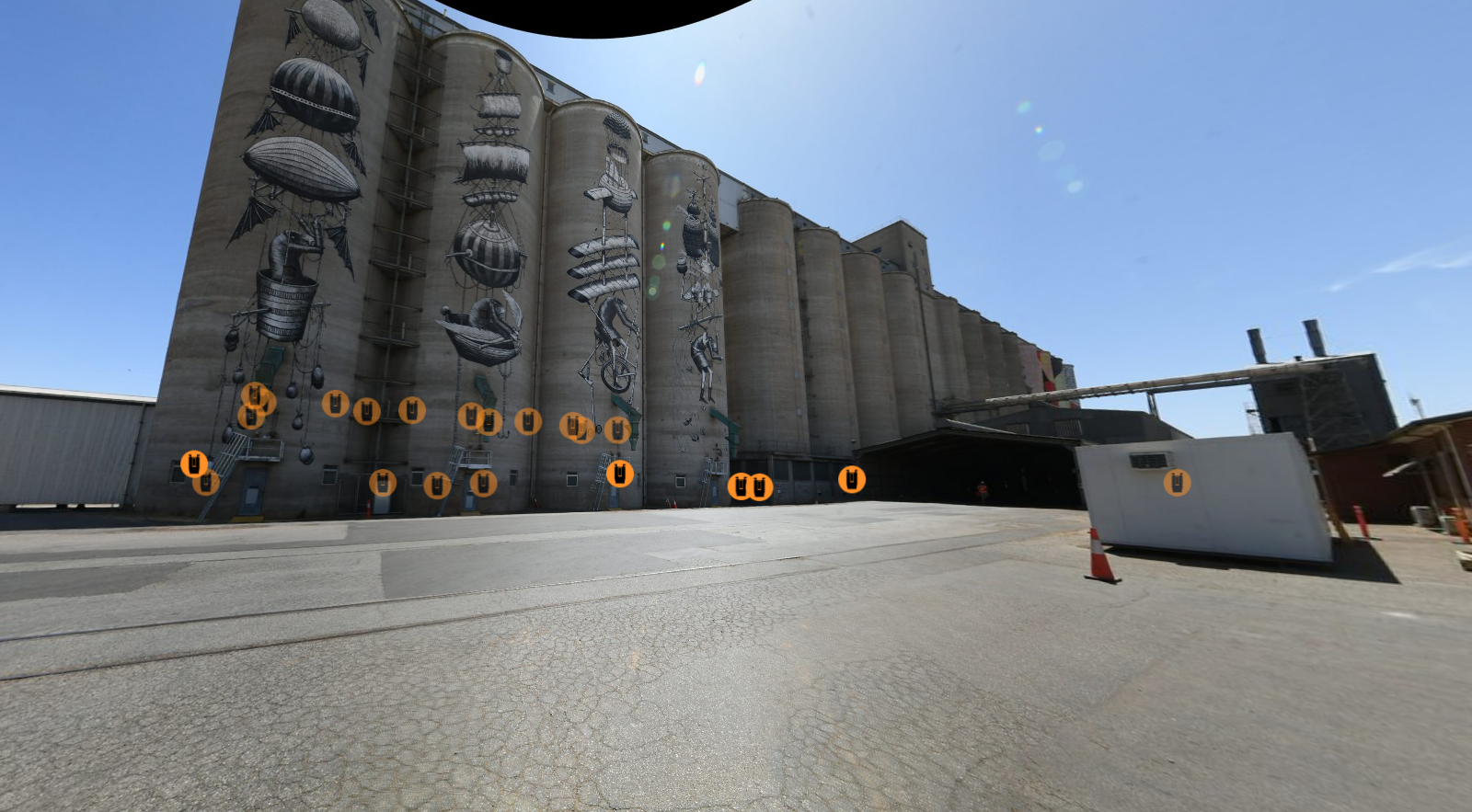
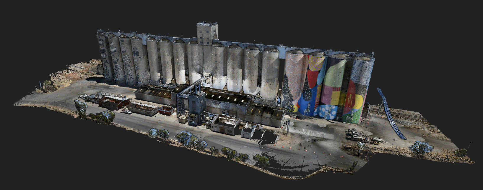
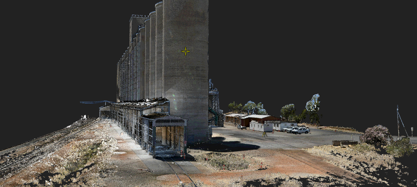
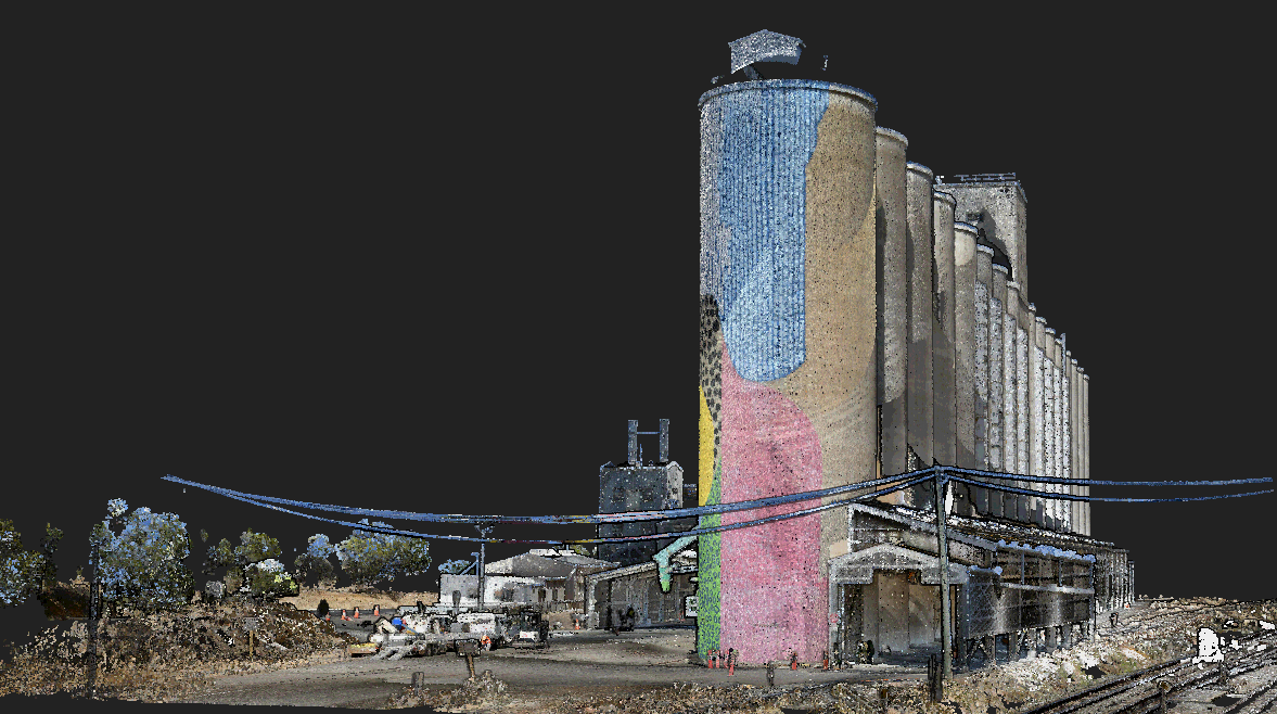
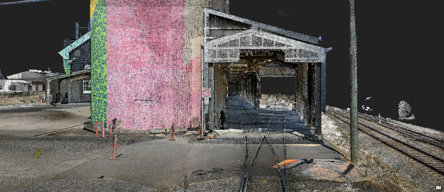
Digital Twin of CBH Grain Terminal in Western Australia captured and supplied by RM Surveys using the RIEGL VZ-400i terrestrial laser scanner
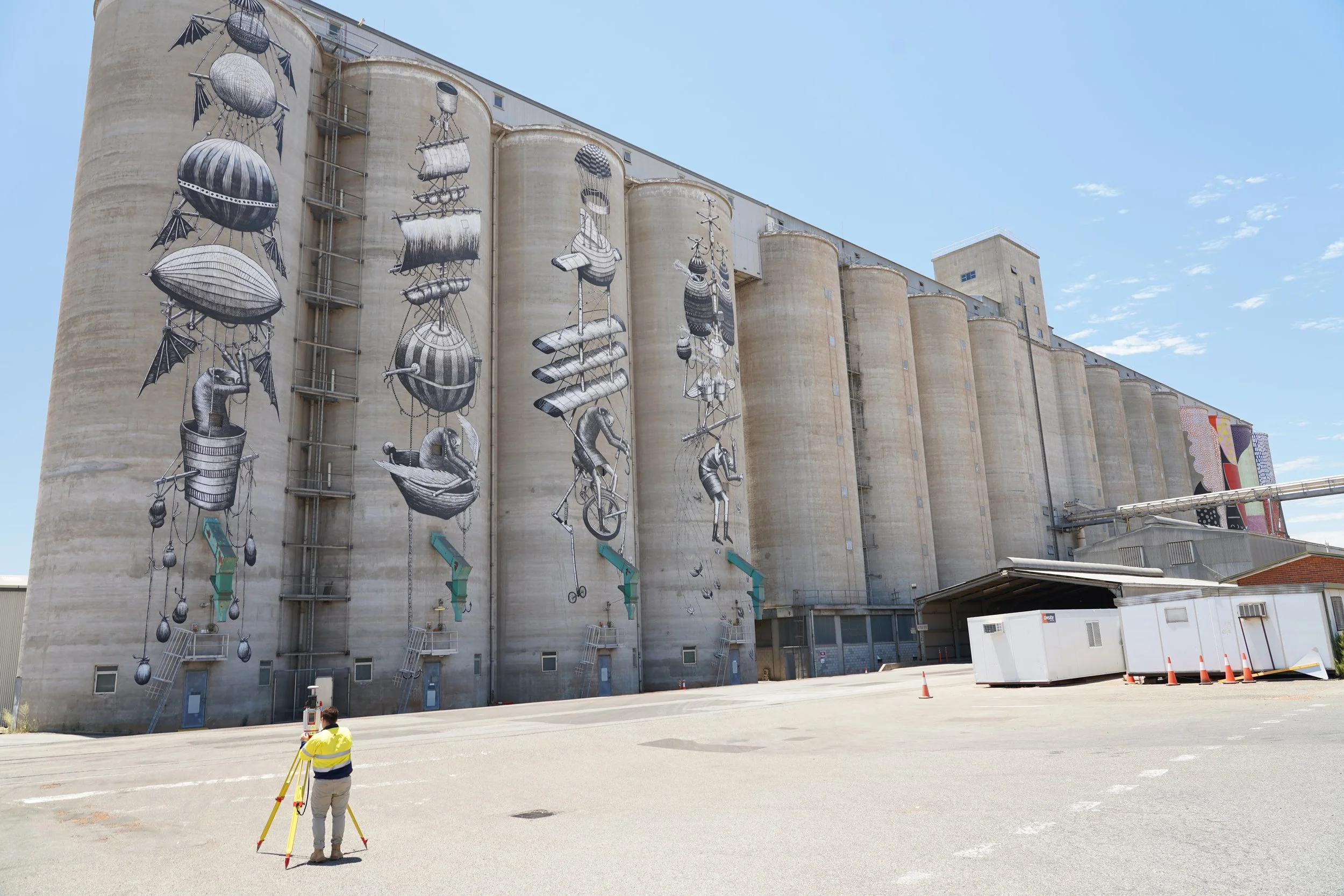
Client: CBH Group
Purpose: The primary objective of this project was to provide valuable insights for the ongoing upgrade works at CBH Group's main grain terminal in Western Australia. The infrastructure is undergoing significant improvements and RM Surveys role was to inform the design and survey aspects of this upgrade.
Choice of RIEGL VZ-400i: The decision to employ the RIEGL VZ-400i laser scanner for this project was driven by the unique characteristics of the grain terminal. The terminal stretches over a substantial area, with dimensions of 200 meters in length and 50 meters in height. To ensure the collection of accurate and clean data across this extensive structure, RM Surveys opted for the RIEGL VZ-400i over alternative laser scanners available from different suppliers. The reasons why this particular scanner and workflow was used includes the following;
Direct GNSS integration: To further enhance the precision of our data collection, we integrated a Global Navigation Satellite System (GNSS) base and receiver with the RIEGL VZ-400i. This integration allowed us to establish a known position within a remarkable 20mm margin for each setup before conducting further registration and survey control tie-ins.
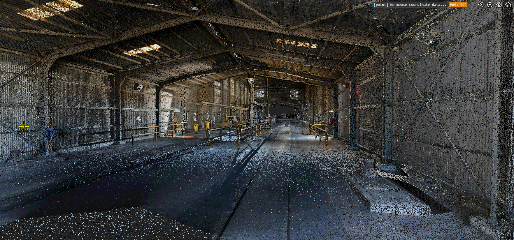
External SLR camera benefits: The addition of an external Single Lens Reflex (SLR) camera brought several advantages to the project. This camera enabled the capture of high-quality panoramic images, which, when combined with the laser scanning data, generated a vivid colourised point cloud. This integration greatly improved the visual representation of the terminal's structure.
Efficiency through RiScan Pro: The adoption of RiScan Pro for data processing and analysis contributed to estimated time savings of 50% compared to other software solutions. This significant reduction in office-based work was primarily attributed to the software's automated filtering and cleaning processes, which streamlined data preparation and analysis.
Time savings in the field: The utilization of the RIEGL VZ-400i with a directly connected RTK GNSS led to estimated time savings of 40% compared to other available instruments. This efficiency translated to quicker data acquisition and reduced fieldwork time.

In summary, the selection of the RIEGL VZ-400i and the integration of GNSS technology, external SLR camera, and RiScan Pro software have collectively enhanced the efficiency and accuracy of the survey and data analysis processes for CBH Group's grain terminal upgrade project. These choices have resulted in substantial time savings both in the field and in the office, ultimately contributing to the successful execution of the project.