Bennett + Bennett
Landslide sites in Tweed Shire, NSW surveyed and monitored for subsidence using a RIEGL VUX-1UAV from a helicopter.
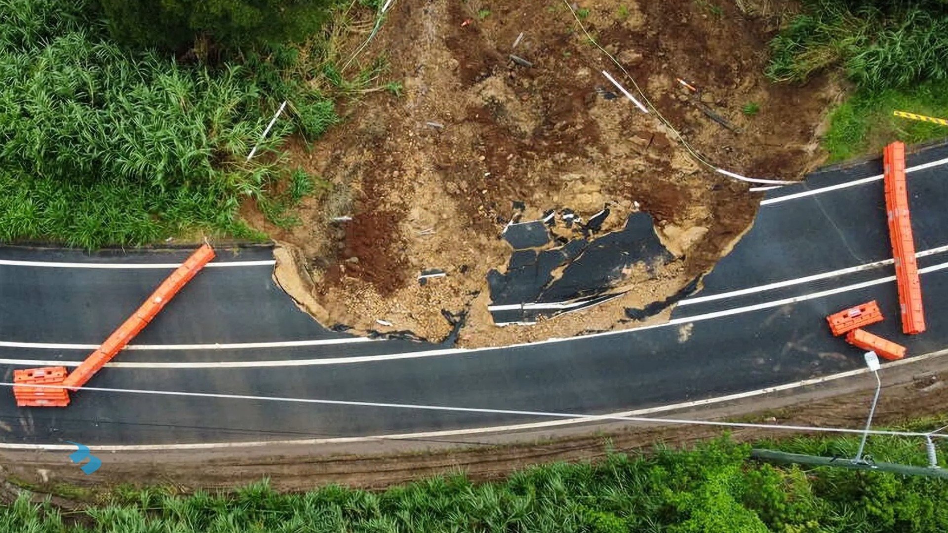
In February 2022, the Tweed Shire faced its most significant floods on record due to the La Niña weather pattern. These floods caused extensive damage, particularly to the local road infrastructure. Bennett + Bennett (B+B) was enlisted by SMEC, GHD, and Tweed Shire Council to conduct surveys at more than fifty landslide sites as part of a $61 million road restoration project.

Above: Locations of landslide sites in the Tweed Shire
Each landslide necessitated a Topographic Survey to evaluate the damage's extent and support the Engineering Design and future construction of repair efforts. The terrain was often challenging, with dense vegetation, making ground surveys difficult. Survey areas spanned both public road reserves and private properties, requiring drone operations and Notice of Entry permissions. Engaging with stakeholders, a priority for Tweed Shire Council, sometimes led to delays of up to two months in obtaining access. With fifty sites to survey, it became evident that an alternative solution was necessary to meet project deadlines and restore vital public assets for the local community.
To expedite the program, a specialized helicopter LiDAR solution using the RIEGL VUX-1UAV was devised, allowing the rapid capture of over a dozen sites in a single day. Initially, this endeavor involved the creation of a bespoke mounting system to securely attach the sensor to a Robinson R44 helicopter. This mounting solution needed to adhere to CASA regulations and be meticulously engineered to ensure it produced the highest possible data quality. Several factors were taken into account, including the strategic placement of a GNSS sensor to minimize interference caused by the helicopter's structure, achieving proper balance, and providing effective vibration dampening. The mount was meticulously designed using 3D CAD software and subsequently sent for fabrication.

Above: R44 Helicopter fitted with RIEGL VUX-1UAV airborne LiDAR system
Following this, the system was assembled, rigorously tested, and calibrated at known locations. The LiDAR system exceeded B+B’s expectations, delivering resolution and accuracy on par with or even surpassing those obtained from their own survey-grade drone LiDAR system. This achievement meant that B+B could maintain exceptional data quality without encountering the logistical challenges associated with remotely piloted aircraft. The helicopter could safely operate above active traffic routes and did not require special permission to fly over private properties. Furthermore, the helicopter could be rapidly deployed and capture data from as many as 14 sites in a single day, a significant improvement compared to the maximum of three sites per day achievable with a drone.
The LiDAR data underwent processing and validation against the ground survey data prior to the creation of the terrain model. This process entailed the categorization of the exposed ground within the point cloud and the generation of a digital terrain model. The aerial data was then harmoniously integrated with the ground survey data to construct a cohesive 3D survey model. Additionally, 2D drawings, incorporating the gathered information, were meticulously crafted and subsequently provided for each site, catering to the needs of all involved stakeholders.

Above: Silhouette view of land slip with critical power and transport infrastructure located directly above.

Above: Example feature survey plan showing contours for engineering teams to design ground remediation works
The provision of dependable geospatial information empowered the engineers to comprehensively gauge the actual scope of the damage. This, in turn, instilled confidence in their ability to design and strategize the remediation efforts, ultimately aiming to restore the community's functionality.
It has been observed that certain sites continue to experience ongoing movement. To address this issue in future, a monitoring program has now been initiated to periodically capture data from these sites. Heat maps will subsequently be generated to visually represent this movement, facilitating in-depth analysis of the ongoing changes. Mapping this change to predict and mitigate potential slips will have an ongoing positive impact on communities living in the area.
See video below for further information about this project, for which Bennett and Bennett recieved the ‘Geospatial Enablement Award’ by Geospatial Council of Australia in 2023.